After construction workers accidentally cut through a petroleum pipeline in 1976 causing a massive explosion the system known as DigAlert was developed. A series of color-coded symbols and markings are now found all over cities and construction sites the world over. While they might be mistaken for simple graffiti, they relate complex and essential information to those in the know. Since the original version developed in California, the system has been adopted by the American Public Works Association, and standards have been set to ensure that there is color and marking consistency. GPR plays a major role in locating these underground utilities and determining what they are. If you’ve ever wondered about the construction graffiti seen in concrete and asphalt, here’s what those symbols mean and how GPR helps.
If you’ve ever wondered about the construction graffiti seen in concrete and asphalt, here’s what those symbols mean and how GPR helps.
Understanding The Colors
Knowing what the colors stand for can help give you a good idea of the immediate contents before you begin to decipher the individual signals.
Red: electric power lines, cables, conduit and lighting cables
Yellow: gas, oil, steam, petroleum, or gaseous materials
Orange: communication, alarm or signal lines, cables or conduit
Blue: potable water
Green: sewers and drain lines
Purple: reclaimed water, irrigation, and slurry lines
Pink: temporary survey markings
White: proposed excavation
Understanding the Markings
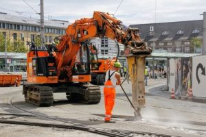
Once you have the color code memorized and can recognize the potential hazard, the next step is to figure out where its boundaries lie. This is where GPR comes in to help site workers identify what lies beneath the ground. Different coded languages exist for other kinds of hazards, but in marking the location, there are several standards to follow. The Common Ground Alliance Guidelines for Operator Facility Field Delineation establishes a standard of spaced markings between four and fifty feet apart should be used to mark the central point of a utility. If there are several conduits, markers should be placed on the outside edges pointing in, making an H form. If the tags are noting the location of a duct system, a diamond shape is used rather than an H.
Concrete Construction Safety Tips from Concrete Visions
Concrete Visions has over 12 years of experience and expertise in concrete scanning and we know how to detect any problems lurking beneath the surface. We use ground penetrating radar accurately and expertly and are familiar with many other methods that can be used when appropriate like concrete x-ray and electromagnetic conductivity. We are also very familiar with the latest construction safety techniques and train all of our workers to do their work quickly, accurately, and safely. If you would like to learn more about how we can help you, give us a call at (410) 766-2210 or visit us online. For more articles and tips, follow us on Facebook, Twitter, LinkedIn, and Google+.